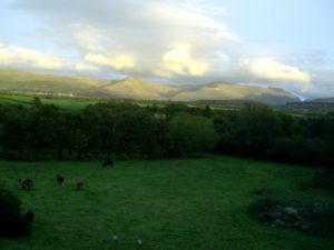
Currently I am living, studying, working and cycling in Wales, North-Wales, in a town next to the Snowdonia National park. I can see the park in the distance from my window. Only 15km on a bicycle path and I am at one of its most famous locations – Cwm Idwal, which has been ranked as the 7th greatest natural wonder in Britain. Last weekend I went there and admired its beauty twice, both Saturday and Sunday.
Information on the Internet and on the Event’s Booklet stated that on Saturday 10th of March at 2pm there will be a guided excursion to Cwm Idwal to a place where Darwin was twice to verify two important theories. I checked on Google Maps that there shouldn’t be a problem getting to the meeting point with a bike and it is also quite close. So, I decided to take the opportunity and take a closer look at the beauty that I can see from my window.
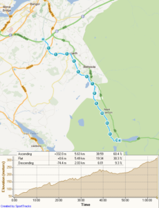
Three days long staring at Google Maps to memorize the path to the meeting point turned out to be useless as on Friday afternoon I got my new GPS. Yeee! Finally, after a year, I have GPS again. It is almost like regaining part of myself. I spent Friday evening studying my new device and preparing it for the first trip. Now I can switch off my brain, switch on my Garmin and go for a ride.
Studying the map turned out to be even more useless as the bicycle path on which I cycle daily to Bangor on the other direction continues up to the very Cwm Idwal. Not long ago I already cycled about 6km on it and new the most important turns. I knew that after about 5km the path will go through an impressive slate quarry and after another kilometer, there will be an impressive waterfall and then a steep uphill.
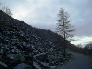
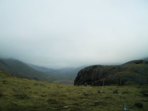
What comes after the uphill I didn’t know and didn’t have an idea. Therefore, my first impressions were especially intense, and I felt like in a fairyland. I don’t recommend you to look at the photos I took! (haha) Although my old bad camera can’t produce good pictures, it will still spoil your first impressions when you will go on your first cycling tour through this valley.The fairyland feeling was enhanced because it was a grey day and hills were covered in clouds. OrangishYellowishGreenishReddish colours and carvings looked more like a computer graphics, not a reality 😀
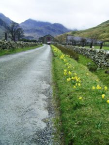
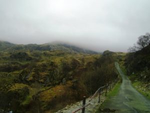
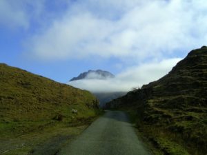
Cycling on the bicycle path was a great enjoyment. Although not too easy as it goes upwards. The total ascend is about 400 meters which for me is quite much as I haven’t cycled anywhere much higher than the highest point in Latvia which is 310 meters. But as the relief is uneven there are even some downhills, therefore, it is not too hard. I can enjoy nature’s “computer art” and look at Welsh longhaired mountain sheep. In a total indifference, two black sheep pass me allowing me to make a close photograph of them.
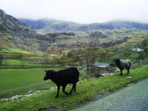
The last kilometer is quite steep, and I am sweating when at 1.50pm I arrive at the Cwm Idwal parking place.This looks like a very popular place for hikers. Parking place is full of people and cars. Young people with big backpacks, old people with big sticks, climbers loaded with ropes.
I am looking for “Darwinian” group. On some stone pole, I find a “poster” which states that Darwin footstep inspection is on Sunday 11th of March at 2pm… Blimey!Whatever. I am starting to get used to these British “tricks”. A couple of other people also stare at the poster in confusion. But I don’t bother too much. I have my Garmin with uploaded geocaches, and I wouldn’t look for them during group walk. It is even better first to look at the beauty on my own to later listen to the story how all this was formed and why did Darwin come here twice. And me like a Darwin – also twice, although not with an 11-year interval.
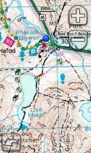
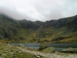
I lock my bike and following other tourists through a gap between hills scramble uphill where Idwal Lake is lying in a mountain gully. Tourist path goes around it and also four Earth geocaches, and two Traditional geocaches are there. So, I can admire the beauty and also try out my Garmin for searching geocaches for the first time.
When standing in the gully, I can feel the millions of years old mightiness of nature. From all sides, small rivers are falling down the mountains creating unique stereo sound.
This place – Cwm Idwal – is a “hanging valley” and is significant for its clear marks of the late Ice Age. But before the Ice Age during the Ordovician period 500 to 440 million years ago everything here was under the sea and had violent volcanic activity. Consequences of these geological activities are very well seen in the folded rock layers. Well OK, to me it became very obvious only on Sunday when the knowledgeable professor pointed on the rocks and explained their geological history.
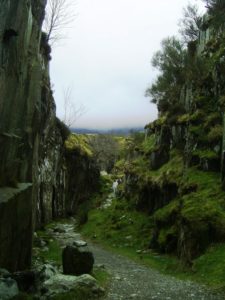
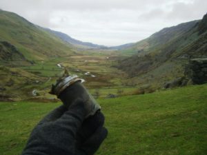
Darwin first came here in 1831 to look for signs of the Ordovician period and volcanic stones and becoming more and more convinced that Earth is terribly old. The folds formed during the Ordovick where ideal snow and ice storages during the Ice Age. And at the end of the Ice Age, all these icy recourses melted and flew down the valley to Bangor. Ok, there wasn’t Bangor at that time, and there wasn’t the nice bicycle path in the valley at that time, of course. But anyway, all these enormous resources slowly slowly slowly flew down the valley smoothening and grooving rocks on its way and carving the valley much bigger and in an ideal U shape which is very characteristic to glacier valleys while river valleys are V-shaped. But this is a typical U shaped valley which starts with the hanging valley where Idwal Lake is located. Darwin came here again in 1842 to look at the landscape and see the obvious signs he didn’t notice before – the signs of glaciations.
“Glaciers in full action start at a mountain. Hundreds of thousands of tons of ice and snow push down from the mountaintop with tremendous weight and force. It is hard to imagine that ice could cut through rock, but that’s exactly what happens with a glacier. This huge unstoppable force grinds out the rock. Close to the mountain, the glacier scoops out a deep hollow before it continues its grinding movement away from the mountain. And when glaciers eventually melt away, a lake is left behind in the hollow at the foot of the mountain. These lakes are called Cwms in Wales.” [http://coord.info/GCQJ01]
Glaciers don’t stand still. They move like a huge frozen river. And they are so huge, and so heavy that they grind solid rock as they inch forward. One way of telling that you are in an area where glaciers flowed is to look at the shape of the valleys. Typical river valleys form a V-shape. But glacial valleys make a much wider U-shape. [http://coord.info/GCQJ06]
And now, in now a day, all the way along this valley goes bicycle path on which I cycled to look at these amazing formations.
On Sunday weather is wonderful and sunny and I am happy that I have a reason to cycle to Cwm Idwal again. And this indeed was the right day and right time when excursion “In the footsteps of Charles Darwin” took place.
The group is quite big, around 40 people. Some enthusiasts impress me a lot – very old men who, as one might think, can barely walk, but they are ready to climb up the hill and walk around the lake. One of them looks like at least 90 years old! He is walking with two sticks and walks very slowly but steadily and finished all walk and listened to the stories very attentively and with interest and asked questions.
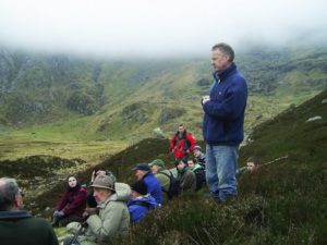
As I have been here already the day before, found geocaches, admired the beauty and made lots of pictures, now I can concentrate on the story told by the professor. Very interesting.
After this informative walk returning home down the U shaped glacier valley rises special feelings. I imagine the valley filled up to the top with ice flowing away, carving the valley and smoothing and grooving the rocks.
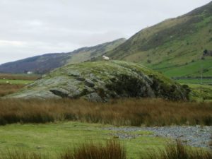
On one of the rocks in the middle of the valley, these marks are explicitly visible.
“This is another sign of glaciers in this valley. The rock began as an irregular shaped outcrop on the floor of the valley. But then the glacier began to flow over it during the last Ice Age. The undersides of glaciers are like very coarse sandpaper. They constantly carry stones, rocks and grit down from the upper mountain. And like sandpaper it has a smoothing effect. Over centuries, like a huge sanding machine, the glacier worked on this rock buried deep beneath it. It smoothed the “upstream” side and the top of the rock into a rounded shape that looks (if you use your imagination) a bit like a sheep. Which is why they are called Roches Moutonnes (French = Sheep Rocks). They were first spotted near glaciers in Switzerland. The “downstream” side of Roches Moutonnes are usually a bit more craggy and rough. The parallel grooves show the direction the ice was moving.” [http://coord.info/GCQJ0E]
So, that’s all I wanted to tell about my weekend.